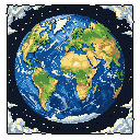
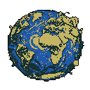
Stylized World Map: Blue Oceans, Grey Continents
This pixel art image showcases a simplified light grey-blue world map with vibrant blue oceans against a stark black background. The continents are clearly outlined in a nostalgic, early computer graphics style.
Read More
The pixel art image depicts a simplified, stylized flat representation of the Earth's continents and oceans. The landmasses are shown in a light grey-blue, clearly outlining the shapes of North and South America, Africa, Europe, Asia, and Australia, along with various islands such as Madagascar, New Zealand, and some Caribbean islands. The oceans are represented by a vibrant medium blue. The edges of the image, particularly the bottom and sides, show a wavy or uneven outline, suggesting the presence of surrounding water or perhaps an abstract representation of the globe's curvature flattened. The entire world map is positioned relatively centered within the frame, although it doesn't fill the full square canvas, leaving a substantial black background on all sides. There are no specific characters or objects interacting with the map, and no implied action. The background is solid black, providing a stark contrast that makes the map stand out. The dominant colors are the medium blue of the oceans and the light grey-blue of the land. The color scheme is simple and limited, using two distinct colors to represent the world, creating a clear separation between land and water. The overall vibe is informative and perhaps slightly nostalgic, reminiscent of early computer graphics or educational software. There are no additional details, text, or UI elements present in the image.